CAPITOL REEF
Utah
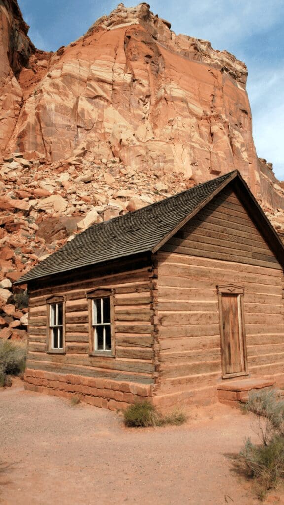
Should you shield the canyons from the windstorms you would never see the true beauty of their carvings.
Elisabeth Kübler-Ross
About the Park
Capitol Reef National Park is a fantastic 100-mile wrinkle in the earth’s surface called a Waterpocket Fold. This hidden treasure of a park is filled with canyons, natural bridges, and rock domes. It is located in the middle of Utah’s Mighty Five National Parks. The drive on Highway 12 between Bryce Canyon and Capitol Reef was magnificent.
Live it up!
Best Things to do in the Park
- Drive the Capitol Reef Scenic Drive to see much of the beauty without leaving your car
- Hike the Capitol Gorge Trailhead to see the Pioneer Register, a collection of names from the Mormon settlers
- See Historic Fruita, where the pioneers settled in the late 1800’s
- Take Scenic Drive Highway 24 that is the main road through the park and is free of charge
- See the Petroglyphs, which are rock art figures created the the Native American inhabitants of this area
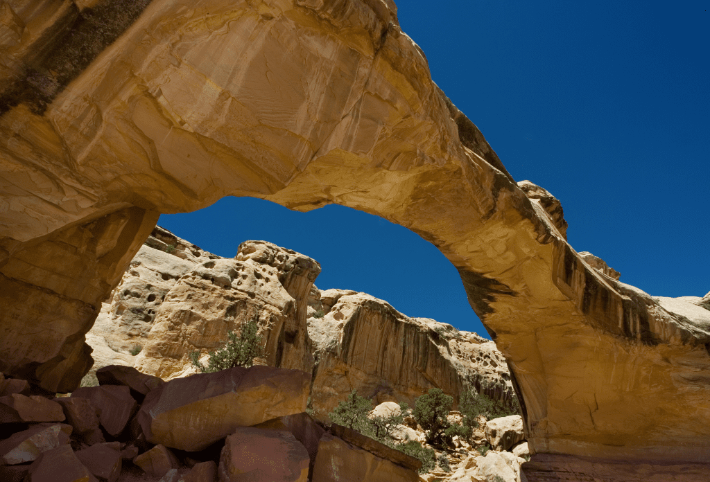
- Enjoy a number of great hikes through the park like the Hickman Bridge Trail
Our Visit
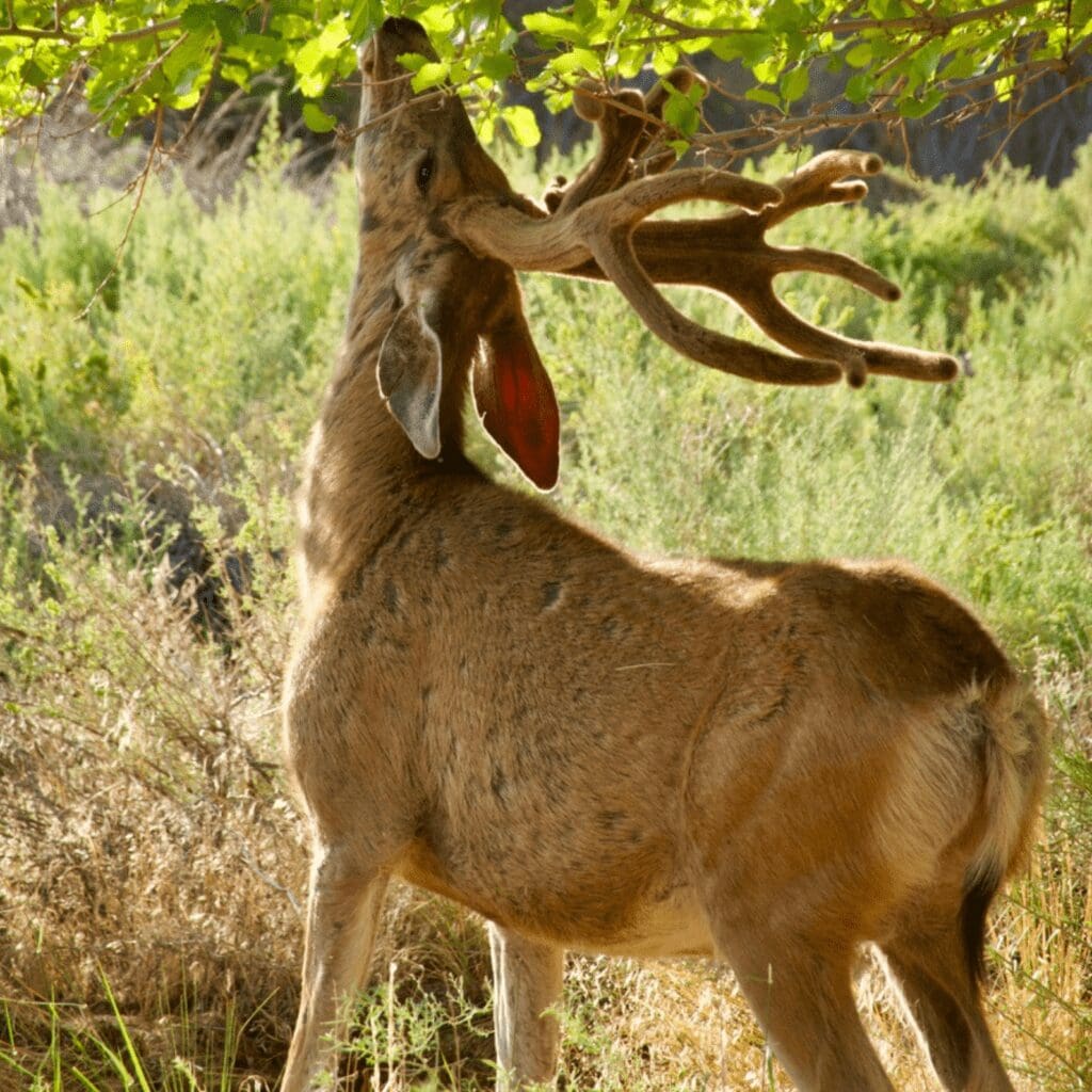
We visited Capitol Reef National Park for a couple of days, and it was the third National Park of the Utah Mighty Five that we saw. The highlights for us were the Hickman Arch Trail and then driving back on a winding dirt road and hiking the Capitol Gorge Trail. We also loved the petroglyphs and all the deer we saw in the park.
Overview
Year Established
1971
Size of Park
240,000
Annual Visitors
1.4 Million
Interesting Fact
The park preserves the Waterpocket Fold, which is a 100-mile long wrinkle of the Earth’s crust that was formed over 50 million years ago
Best Time to Visit Capitol Reef NP
We have linked a great website to this button showing the weather for this location by the month. Click below to be taken to Weather-and-Climate.com.
Park Information
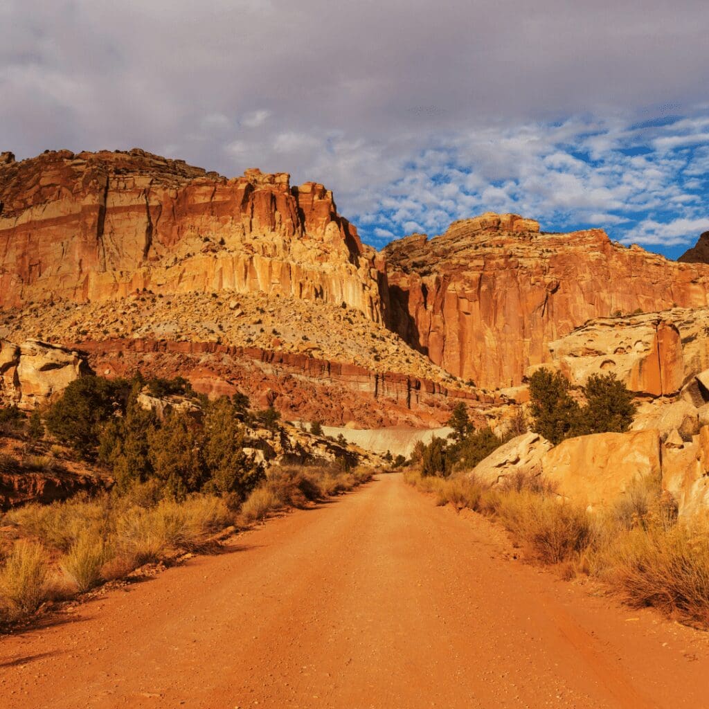
Known for its diverse ecology and landscape, Capitol Reef National Park is spread over seven life zones and is home to almost 1200 plant and animal species. The different life zones provide a natural habitat to numerous species and make the park worth visiting.
Spread across 381 square miles, the park is located in south-central Utah. Initially designated as a national monument in 1937, it was established as a national park in 1971 to preserve the desert landscape. The diverse landscape comprises 19 different rock layers and elevations. Capitol Reef National Park is a hidden gem with numerous cliffs, canyons, domes, and bridges.
The Waterpocket fold is a unique geological feature of the park and distinguishes it from other national parks. Another attraction of the park is its night sky; its remote location has extremely low levels of light pollution, making it an ideal place for stargazing during the night.
Best Hikes in Capitol Reef National Park
Capitol Reef has a wide range of hiking trails with varied elevations and difficulty levels. It has something to offer everyone, from kids and families to seasoned hikers and experienced backpackers. Whether you are visiting to have a relaxed time and enjoy the landscape or to challenge yourself and explore some of the more remote areas of the park, you will be satisfied by the Capitol Reef National Park. The best hikes are usually narrow and lead to twisting gorges, slot canyons, and beautiful viewpoints.
Hickman Bridge Trail
The Hickman Bridge trail is one of the most popular hiking trails in the parks, as it is suitable for hikers of all types. It is the perfect option for visitors looking for easy and quick trails. With a 1.7-mile roundtrip, this trail is incredibly easy and offers some stunning views to the hikers. It will take you along the Fremont River, back to the Hickman Bridge, and is also connected to the Rim Overlook and Navajo Knobs Trails. This bridge formation is iconic, and it’s a trail we love. We suggest you hike clockwise to enjoy approaching the arch from behind for the best hikes.
Grand Wash Trail
Grand Wash Trail is another popular trail due to its ease. The round trip is 4.5 miles. It is a very important area of the park and is a gorge that is part of the upper portion of the Waterppocket Fold. It is flat for most of the length of the trail and can be tight at the Narrows.
The Narrows section of the trail is famous for the towering canyon walls. The hike up to this point takes around 20-30 minutes from the beginning. This part of the trail is also known as the Lower Trailhead due to its lower elevation. The total elevation is 341 feet.
Goosenecks Overlook and Sunset Point
These two short trails are so close to one another that people often consider them a single trail. The end of Goosenecks Road leads to two short trails, Goosenecks Overlook, with a 0.2 miles roundtrip, and Sunset Point, with a 0.6 miles round trip.
The total elevation of this trail is 544 feet, and it offers the best views just an hour before sunset. Goosenecks trail also has a section on the way that offers views of Sulphur Creek Canyon and the ‘Goosenecks,’ making it a popular hiking trail among visitors.
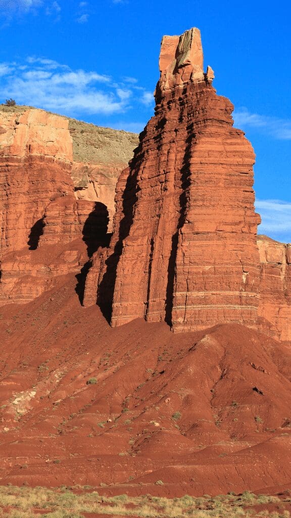
The Sunset Point Trail is also quite famous as it offers incredible views of the park’s landscape and has several benches installed at different points for the hikers to sit and enjoy the views. Once you get to the end of the trail, you will see a viewpoint that offers sweeping views of the diverse landscapes of the Capitol Reef National Park. It offers views of the Waterpocket Fold, Chimney Rock, Ferns Nipple, Boulder Mountain, and Mount Ellen.
Cassidy Arch Trail
With an elevation of 670 feet, the Cassidy Arch Trail is not for inexperienced hikers. Although it isn’t a challenging trail, it can still be quite tough for children and less experienced hikers. It is considered a moderate difficulty level trail and is known for offering some of the most beautiful views in the park. Hikers can witness the unique landscapes of Capitol Reef from this 3.4 miles roundtrip trail.
Be extra careful when passing through the few switchbacks and the last section of the trail, which can be trickier to follow. In addition, there are risks of flash floods, so check the weather predictions in advance and avoid the Grand Wash and Cassidy Arch Trails when it rains.
Capitol Reef Petroglyph Trail
Another short 0.3-mile trail is the Capitol Reef Petroglyph Trail. The trailhead is right next to Utah State Route 24. With an elevation of 49 feet, it is covered with beautiful cottonwood trees and also gives the hikers a chance to see the anthropomorphic and geometric petroglyph designs. These ancient designs have a lot of history and are believed to have been created by the Ancestral Puebloan people and Fremont natives.
Some of the designs date back to 300 and 1300 AD and give you an insight into the lives of the people of the past. In addition, you can learn about indigenous religious or mythological events, resource locations, hunting techniques, and travel routes. This information can be found on the rock surfaces throughout the trail, either pictographs or petroglyphs. It is an excellent option for those looking for easy and family-friendly trails, as Capitol Reef Petroglyph Trail is wheelchair friendly.
These designs fascinated us, and we were so intrigued by their features.
Camping in the Park
The only developed campground in Capitol Reef is the Fruita Campground which has only 71 sites, so you will have to get a reservation in advance. The reservation can be made anywhere between March 1 – October 31. Fruita Campground is like an oasis in a desert; there are basic facilities like restrooms with running water, picnic tables, and a fire pit.
Besides the reservation period, the campsite is open on a first-come, first-served basis. However, if you do not get a reservation, don’t worry; there are plenty of camping alternatives in the area.
Camping options near the park
Unlike the Fruita camping ground, which is open all year, most campgrounds outside the park are only open seasonally and remain closed during the harsh winters. Due to the 6000-9000 elevation, the temperature drops below freezing during the winter. Some of the best camping options near Capitol Reef National Park are the Wonderland RV Park, Thousand Lakes RV Park, Sand Creek RV Park, Oak Creek Campground, and the Pleasant Creek Campground in Dixie Forest.
Best Viewpoints
Suppose you are more interested in a relaxed and laid-back outing and are looking for something other than hiking. Then exploring the Capitol Reef National Park by driving along the diverse area can be a great option. The scenic drive allows the visitors to enjoy the park’s beauty fully.
Slickrock Divide
The park has so much to offer that this incredible location often gets overlooked; however, be sure to put this gem on your list when visiting the Capitol Reef National park. The Slickrock divide is a photographer’s dream location. It offers a view of the northern runoff falling into Grand Wash and the southern runoff falling into Capitol Gorge, which makes for a mesmerizing sight.
Panorama Point
The panorama Point is just a small 0.3-mile-long hike away from the parking area and is a great place to visit just around sunrise. The hike is quite pleasant and is suitable for children, so feel free to stay with your family.
Upper Cathedral Valley Overlook
The Upper Cathedral Valley Overlook offers sweeping views of the beautiful valley. It is a great place to visit if you are an early riser and want to catch the picturesque sunrise at the Capitol Reef National Park. To reach this viewpoint, you need to take a 90-minute drive from Fruita through Torrey and parts of the FishLake National Forest, so be sure to get up as early as possible in the morning if you want to get there in time to see the sunrise.
Sunset Point
As the name suggests, Sunset Point is where all the visitors go to see the most beautiful sunsets in the park. So make the short hike to the top and witness the spectacular view of the sun slowly disappearing behind the horizon.
State Information
Click on the button to explore the state and travel guides for the area.

Getting to the Park
The closest major airport to Capitol Reef National Park is Grand Junction Regional Airport in Colorado, which is 196 miles to the east. The best place to stay is in Torrey, Utah.
Explore another National Park in the USA
We’ve visited 51 of the 63 parks. Check out our other guides.
